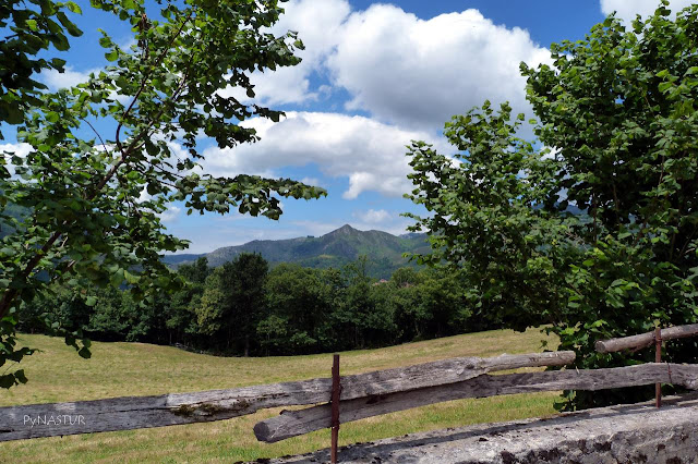
CASTAÑERU MONTES WALKING TRAIL SL.AS-12 ASTURIAS - SPAIN
Walking Trail: Circular
Itinerary: Rioseco - Castañeru Montes - Rioseco
Distance: 5.3 km
Walking Timescale: 2 h
Dificulty: Easy
Height Difference: 220 m aprox.
On Mountain Bike: Sí, with hard ramps the first 2 Km.
Kids: Yes
Date Completed: 08/07/2012
Location: Lugar de Rioseco, 195, 33993 Sobrescobio, España
TRACK OF THE ROUTE.
To reach the trail head coming for the AS-117, up to Rioseco, we take the SC-2 road to Soto de Agües and just past the bridge, we turn left and park the car. You can also view the LOCATION.
This hiking trail is very simple and short but not without its charm and considering that runs almost entirely by a beautiful chestnut forest. It is fairly well marked except in a couple of places where we must be careful not to deviate. On this map, we´ll explain later where those places are.
 |
| Castañeru Montes Orthographic Map Asturias |
 |
| Castañeru Montes Topographic Map Spain |
We start walking up the road till we get to this traditional construction used in the old days by the village women to wash the clothes. A few meters ahead we just turn right to get into the Chestnut forest.
 |
| Castañeru Montes walking trail Asturias |
We continue the way up almost all the time in the shade of the chestnut trees, to the area known as The Tumbon and, passing the well of Foncarrón, which we did not see because it was somewhat hidden on the right side of the track. In any case, being a short walking route, if we take some water, it will be more than enough to make it smooth.
Soon we reach the Trepe Meadows in this photo and the following
 |
| Trepe Meadows Asturias |
.JPG) |
| Trepe Meadows Asturias spain |
.JPG) |
| Cueria Meadows Asturias |
... beside this hut. Our idea was to stop eating at Castrín Recreational Area, but it got a little late and this little meadow beside this huts, wasthe perfect place for lying a time while enjoying the sandwich and the tranquility of the place.
We continue the walk, penetrating back into the Castañal, but we shall also see some other oak and plenty of holly trees. From here the route is almost flat and, past the place known as The Castrín, it goes down hill all the way until the end. At this crossroads, the panel tells us that we come from Rioseco, and we are going to the Recreation Area The Castrín.
soon reach this clear in the forest, known as the Castrín, where if we don´t keep a watchful eye, and continue straight, we will go down directly to the road. Here we have to get out to the right ...
.. in this picture, we continue to the left, rather than follow the small path that we see in front ...
In reaching this road, marked on the map as "cruce" we continued straight crossing the road, but there is no indication and, according to what we read about the route, here we should continue to the right and up the road. The issue is that the road ends a few meters away, in a fence and a building of considerable size, which we later found out to be "The Center for Recovery of wildlife" on which have been spent several million euros to be currently closed for lack of funds And on the other hand, it has been built in what once was the Recreational Area of the Castrín. No comments.. neither recreation area nor recovery center ... Luckily we ate the sandwich a while ago. By the way, in the Commonwealth Nalón Valley website, it says this recreation area is still there for the "enjoyment of hikers" .. Anyway, we decided to continue on the path crossing the road ...
 |
| Redes Natural Park Castañetu Montes Asturias |
 |
| Redes Natural Park Castañetu Montes Asturias |
 |
| Redes Natural Park Castañetu Montes Asturias |
A little further down, almost reaching the end of the route, we can see on our left the village of Villamorey.
.JPG) |
| Villamorey View from The Castañeru Montes Asturias |
.JPG) |
| Iglesia de Santa María La Real - La Polina - Rioseco |
.JPG) |
| Church of Santa Maria la Real - The Polina - Rioseco - Redes Natural Park |
 |
| "Horreo" (traditional Asturian construction) in the village of Rioseco |
Here we leave you the TRACK OF THE ROUTE.
Greetings
PynAstur

.JPG)


.JPG)
.JPG)
.JPG)
.JPG)
.JPG)
.JPG)
.JPG)
.JPG)
.JPG)
.JPG)
.JPG)
.JPG)
.JPG)
.JPG)
.JPG)
.JPG)
.JPG)
.JPG)

No comments:
Post a Comment